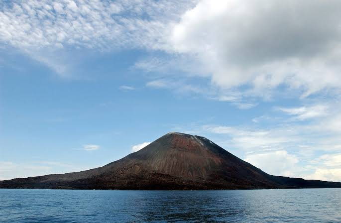
Two new island like formations have appeared in the waters surrounding Indonesia’s Anak Krakatau after a powerful September eruption, giving scientists a rare opportunity to watch volcanic geography change almost in real time. The formations were identified through Sentinel satellite imagery in the Sunda Strait between Java and Sumatra, while Indonesian authorities continue examining whether they are genuine new volcanic landforms or temporary accumulations of erupted material.
Satellite Images Reveal Two Emerging Formations
The newly observed formations sit on opposite sides of Anak Krakatau. Indonesian volcanic monitoring officials said one formation was located about 760 meters northwest of the volcano and the other about 495 meters away on its southern side. Their positions create an unusual alignment around the active volcanic cone and have immediately attracted attention from volcanologists, geologists and marine researchers.
The findings followed a major eruption in early September that continued for about 25 hours. The episode produced ash, lava and other volcanic material and caused significant disruption to regional aviation. More than 300,000 passengers were reportedly affected after airports were temporarily closed because of volcanic ash.
Although the formations have been widely described as new islands, Indonesian authorities are taking a more careful scientific position. Rita Susilawati of the Centre for Volcanology and Geological Hazard Mitigation said further research is required before determining exactly how the formations developed. Scientists still need to establish whether the material rose from new volcanic vents beneath the water or accumulated from deposits produced during the eruption.
Why Scientists Are Watching Anak Krakatau Closely
Anak Krakatau has one of the most remarkable geological histories on Earth. The volcano developed inside the enormous caldera created by the catastrophic 1883 eruption of the original Krakatau volcano. That eruption reshaped the surrounding landscape, generated enormous tsunami waves and became one of the most closely documented volcanic disasters of the nineteenth century.
Anak Krakatau itself emerged from the sea during the twentieth century. Several temporary landforms appeared beginning in 1927, but erosion removed them before a more permanent island developed in 1930. That history provides an important warning for interpreting the latest formations. What appears to be a new island today may not remain above sea level for years, or even months, if waves, tides and unstable volcanic deposits wear it away.
The United States Geological Survey explains that volcanic landscapes can grow through repeated accumulation of lava, ash and other erupted material. When such material accumulates in or near the sea, the resulting land can be particularly unstable because newly deposited volcanic rock may not yet have developed the strength and structure of older terrain.
The September Eruption Changed More Than the Skyline
The emergence of the two formations is only one part of the recent geographical change around Anak Krakatau. Indonesian geological authorities have also reported a substantial increase in the volcano’s land area following repeated eruptions.
Satellite analysis indicated that approximately 32.8 hectares of additional land had accumulated around parts of Anak Krakatau. The increase was associated with deposits of pyroclastic material and lava generated during sustained eruptive activity between September 4 and September 6.
Separate monitoring data indicated that the overall land area of Anak Krakatau had reached about 341.5 hectares by mid September. That figure was larger than the island’s area before its devastating flank collapse in December 2018, when a major landslide generated a deadly tsunami across the Sunda Strait.
These measurements demonstrate how quickly volcanic terrain can change. A coastline that appears stable from a distance can be expanding, collapsing or shifting beneath the water at the same time. For scientists, that makes satellite observation and repeated mapping especially valuable.
What Could Have Created the New Land
There are several possible explanations for the new formations. One possibility is that magma moved through fractures beneath the caldera and reached the seafloor through openings away from the main volcanic cone. Another is that lava, ash, rock fragments and other eruptive material accumulated underwater until the deposits rose above the surface.
The distinction matters because a newly exposed mound of volcanic debris does not necessarily represent a new volcano. A volcanic island can develop through repeated eruptions from an established vent, while loose material can also pile up rapidly around an existing volcanic system.
Scientists therefore need information that satellite images alone cannot provide. Field surveys can help determine the height, shape, stability and composition of the formations. Marine measurements can reveal whether the structures are connected to deeper volcanic features or simply resting on accumulated deposits.
Why the Formations May Not Last
New volcanic land is often fragile. Fresh deposits can contain loose fragments with weak internal connections, allowing waves and currents to remove them rapidly. If the formations are not supported by continuing volcanic activity, erosion could gradually reduce them until they disappear beneath the sea.
The history of Anak Krakatau itself provides a striking example. Temporary landmasses appeared in the caldera during earlier periods of volcanic activity and were later destroyed by erosion. That means the latest formations should be viewed as active geological features under observation rather than immediately treated as permanent additions to Indonesia’s map.
The USGS research on volcanic land entering the ocean also shows why fresh volcanic coastlines can be hazardous. Newly deposited material may collapse suddenly, while interactions between hot lava and seawater can produce explosions, unstable slopes and dangerous steam.
Marine Ecology Could Change Alongside the Geography
The geological story also has a biological dimension. When volcanic material enters shallow marine environments, it changes the physical structure of the seafloor. New rock surfaces can eventually become habitat for microorganisms, algae, invertebrates and other marine organisms, although the early environment may be harsh because of heat, unstable sediments and altered water chemistry.
Over longer periods, stable volcanic surfaces can become part of a developing marine ecosystem. Organisms that attach to rock may establish colonies, followed by fish and other species that use the new structures for shelter or feeding. The process is gradual, and researchers will need repeated observations to determine whether the latest formations become persistent ecological features.
At the same time, eruptions can temporarily disrupt existing ecosystems. Ash and volcanic particles can enter coastal waters, while changes in sediment and water chemistry may affect organisms living near the eruption zone. The ecological consequences therefore depend on both the intensity of volcanic activity and how long the new geological features remain in place.
Satellite Technology Gives Scientists a New View
The discovery also highlights how modern Earth observation has changed volcanic research. Instead of relying exclusively on boats, aircraft and ground teams operating close to an active volcano, scientists can compare satellite images taken at different times and identify changes across areas that may be too dangerous to approach.
Sentinel satellites are particularly useful because they can provide repeated observations of volcanic regions. The European Space Agency notes that satellite systems can help scientists track volcanic ash, gas emissions and changes in the ground. Such information can support both scientific research and emergency response.
For Anak Krakatau, repeated satellite observations can help researchers determine whether the two new formations are growing, shrinking or changing shape. Images collected over the coming weeks and months could become as important as the first discovery because they may reveal whether the structures are temporary deposits or the beginning of more permanent volcanic land.
A Living Laboratory in the Sunda Strait
The waters around Anak Krakatau offer scientists an unusually visible example of Earth’s geological processes. The region sits within one of the most volcanically active areas of the planet, where tectonic forces continually influence earthquakes, magma movement and volcanic activity.
For people living around the Sunda Strait, however, the science carries a more immediate human meaning. Volcanic activity can affect transportation, fishing, tourism, aviation and coastal safety. The memory of the 2018 tsunami also remains deeply connected to the region, making careful monitoring essential whenever Anak Krakatau becomes more active.
Authorities have advised people to remain outside the designated exclusion zone around the eruption centre. The current alert level has been reported as Level 2 on Indonesia’s four level volcanic warning system, but the presence of new formations does not mean that the area is safe for recreational exploration. Fresh volcanic terrain can be unstable even when visible activity appears limited.
What Comes Next for Anak Krakatau
The next stage will be observation. Scientists will continue comparing satellite imagery, geological measurements and reports from people operating in the surrounding waters. Direct field research may eventually provide the evidence needed to determine the composition and origin of the formations.
For us, the most compelling aspect of this event is not simply that two pieces of land have appeared. It is that the process gives researchers a rare view of geography being created before our eyes. Maps usually make coastlines appear permanent, yet Anak Krakatau reminds us that the boundaries between land and sea can change with remarkable speed.
Whether the two formations become lasting islands or slowly disappear beneath the Sunda Strait, their appearance has already provided valuable scientific information. They offer a natural laboratory for studying volcanic island formation, coastal erosion, marine ecology and the interaction between magma and seawater.
The landscape around Anak Krakatau is therefore not finished. It remains active, unstable and closely watched. Every new satellite image may reveal another stage in a geological story that began with the catastrophic Krakatau eruption of 1883 and continues today beneath the waters of the Sunda Strait.